
PostGIS high availability is more than replication
A replica is not a failover plan. What actually has to be in place for a spatial database that must stay up.
We design, build and run geospatial systems on PostgreSQL/PostGIS, GeoServer, QGIS, OpenLayers and MapLibre, engineered for high availability in infrastructure and government.
MaptIQ Consulting is a Hungarian GIS company founded in 2019 by engineers with decades of experience in spatial registry and analysis systems, cartography, remote sensing and data warehouses.
We work with the open source geospatial stack (FOSS4G) because it gives our clients full control: no licence limits, no vendor lock-in, and code that can be audited and maintained for decades.
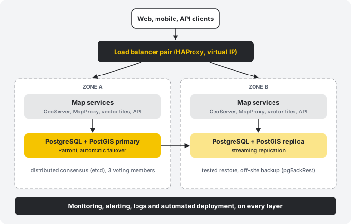
Replicated PostGIS, redundant map services, automatic failover, tested backups and monitoring. Designed for the day something breaks.
Messy legacy data into a clean spatial database, faster. AI drafts mappings and checks, engineers review, pipelines stay reproducible.
Spatial databases, back ends, engineering modules and web map front ends, built as modular, scalable systems.
Move from proprietary GIS to FOSS4G in controlled steps, or run both side by side as a hybrid.
We stay after go-live: monitoring, updates, security patches and an engineer who knows your system.
When a network registry, a road management system or an emergency map goes offline, people notice. We build geospatial platforms for organisations that cannot afford that.
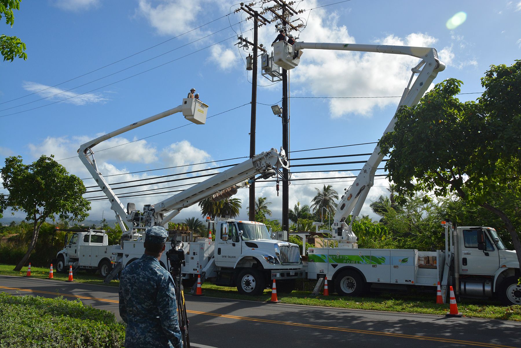
Live map, routing, workforce optimisation and geocoding for an electricity and gas distributor, at thousands of work items a day.
Specification and quality assurance for the geospatial part of a project worth tens of millions of euros.
Open source, entirely on the city's own infrastructure, with hundreds of layers, audit trails and right-sized availability.
Mature, widely adopted open source projects, chosen because they are proven in production.
The spatial database at the core of nearly every system we build.
OGC services, vector tiles and tile caches that scale horizontally.
Fast, accessible map front ends, from simple viewers to 3D data exploration.
Editing, analysis and cartography for the office, data collection for the field.
A common misunderstanding, and the reason many organisations hesitate. It is the other way round.
Open source is about the program code, not about your data. Your data lives on your own servers, behind your own access rules, exactly as in any other system.
Open code can be audited down to the lowest level, by us, by your security team or by an independent tester. You do not have to trust a vendor's promise, you can check it. Flaws are found and fixed in the open by a worldwide community.
We have not met a functional or performance requirement that FOSS4G tools could not meet, from demanding editing workflows to very large datasets. Where something is missing, open code means it can be built.
Every GIS project starts with data nobody trusts: old shapefiles, CAD drawings, spreadsheets, legacy databases. We use AI to profile the sources, propose schema mappings, generate transformation code and write validation rules, then our engineers review everything.
The result is a normal, versioned, repeatable pipeline. The AI speeds up the work, it does not run unattended in production.
We design for failure first: redundancy, failover, backups you have actually restored.
Open source and open standards. You own the system, the code and the data.
The founders design and review the systems themselves. No hand-off to a junior team.
Modular systems, agile delivery and automated DevOps from the first commit.
The founders of MaptIQ created SURVIOT, a platform for structural health monitoring of tunnels, bridges and buildings. We developed it from 2020 on the M85 motorway tunnel construction in Sopron, and when SURVIOT Monitoring Ltd. was founded in 2022 we transferred the intellectual property to the new company, which now develops and sells it.
SURVIOT collects sensor data around the clock and serves it to many users in a web application, with real-time alerts. Running a data platform that engineers rely on day and night is exactly the experience we bring to your GIS.
A replica is not a failover plan. What actually has to be in place for a spatial database that must stay up.
How we use language models to speed up spatial data migration while keeping pipelines reproducible, reviewed and traceable.
Tell us about your system. The first consultation is free.